Wondering if DJI P4 multispectral is worth it? This DJI P4 Multispectral review can help you understand if the DJI P$ multispectral is the right choice for you! Check it out!
The world’s leading DJI Drone Company designed a multispectral imaging drone called the DJI P4 Multispectral designed to gather and analyze agricultural data, as we are moving forward, we need innovative ways to feed our population by forcing intelligence in agriculture industry.
This drone is based on high precision multispectral that lets you see and give a deep observation of agriculture site by generating vegetation index maps and provides you absolute results through integrated spectral sunlight sensor.
This flying tool can monitor and understand vegetation health which a human eye cannot observe. The sensors can alert you about the insects and soil condition which results in increasing the yield of crops and also providing work efficiency to farmers by keeping them updated about the land they manage.
- Related: DJI Phantom Pro 4
- Related: DJI Phantom 4RTK
- Related: DJI TERRA Review
DJI P4 Multispectral: Key Features:
- Multispectral Imaging system
- Live NDVI View
- RTK module
- TimeSync
If you want a quick overview about design and specs of DJI P4 Multispectral then a spec table is given below with all the necessary information.
DJI P4 Multispectral: Multispectral Tech and Surface Observation:
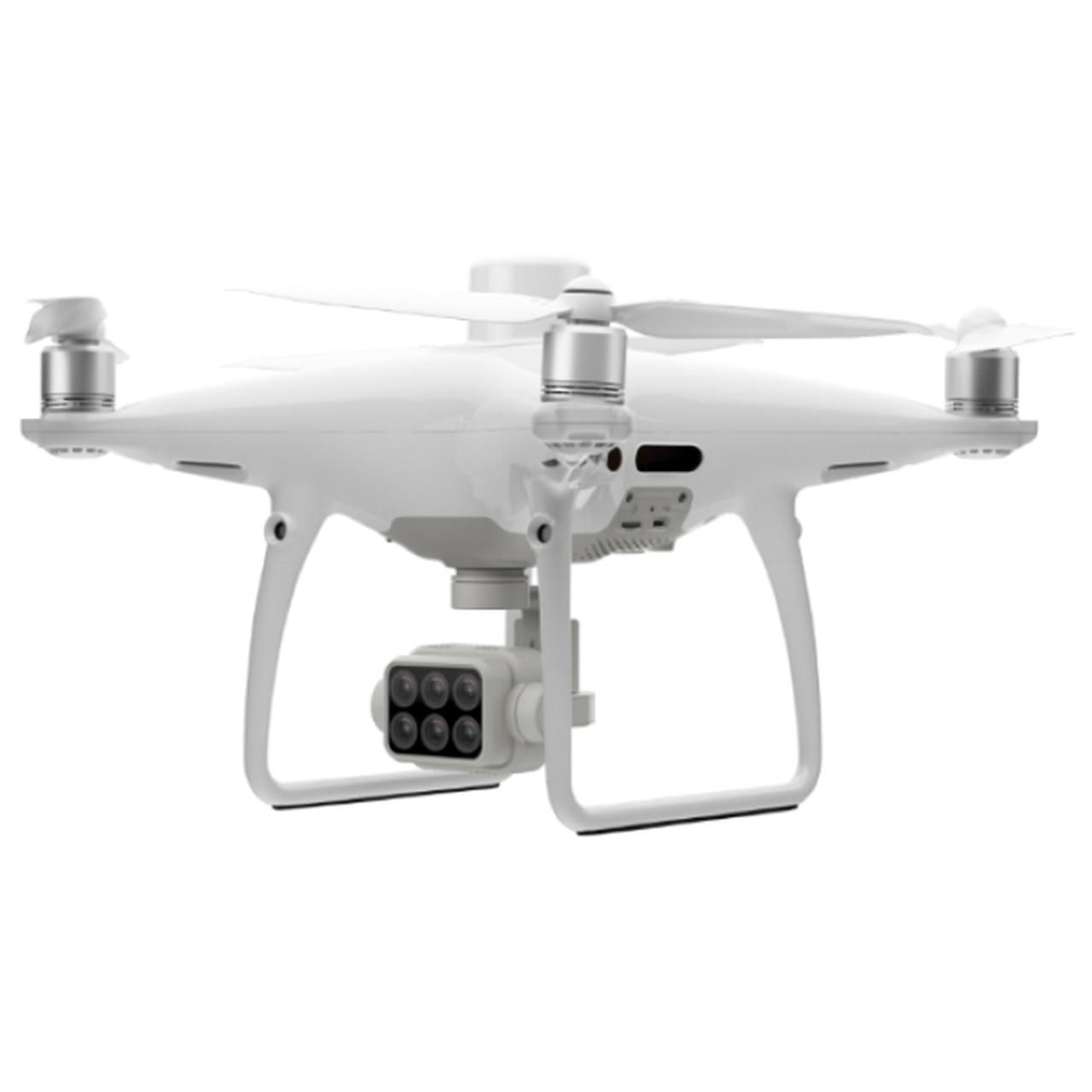
The DJI P4 Multispectral can easily capture data about the plant health and vegetation management through multispectral technology infused inside the drone within a max flight of 27 minutes with a monitoring range of 7km because of the OcuSync system. Its built-in imaging imaging system can easily capture agriculture images with 1 RGB camera and a multispectral array of camera covered with blue, green, red, red edge and near infrared bands.
DJI P4 Multispectral: Sunlight Sensor:
The sunlight sensor is placed on the top of the DJI P4 to achieve accurate NDVI results, the sensor can capture solar irradiance which increases accuracy and stability of collected data through different times of a day and finally it is combined with post processed data to form vegetation index maps.
DJI P4 Multispectral: RGB and NDVI Dual Monitoring:
This drone can provide us aerial monitoring in two views, we can simply switch between RGB and NDVI (Normalized Difference Vegetation Index) analysis which can deeply observe the land we want to manage through aerial monitoring covering a large area of land and alerting us about where the attention is needed.
DJI P4 Multispectral: Centimeter Level Precision:
The DJI P4 Multispectral TimeSync system provides us real time centimeter-level accurate measurements with the help of all six cameras, the TimeSync technology aligns the flight controller, RGB and NB cameras, and RTK module, fixing the positioning data to the center of CMOS and ensuring each photo is taken by most accurate metadata. All cameras go through a rigorous calibration process where radial and tangential lens distortions are measured. The distortion parameters gathered are saved into each images metadata, letting post-processing software adjust uniquely for every user.
DJI P4 Multispectral: D-RTK 2 Mobile Station and NTRIP Compatibility:
The RTK can be positioned without any internet connection by simply connecting the drone to the D-RTK 2 High Precision GNSS Mobile station and NTRIP (Network Transport of RTCM via Internet Protocol), or store the data to be used by PPK (Post Processed Kinematics).
DJI P4 Multispectral: Design and Specs Table:
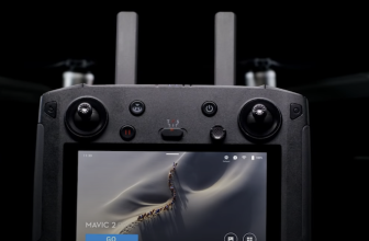
The design of the DJI P4 Multispectral is exactly like the standard DJI phantom 4, the phantom 4 has been reviewed widely, and has been given a very positive consensus when it comes to its performance in the air, many call it to be the most easiest drone to fly by DJI, its large size and gracious amount of throttle power help a lot with that, and the extended landing pads do make landing and taking off, two of the hardest things to do quite a breeze.
Design wise, its good that DJI stuck to the tried and trusted design of the phantom 4. It looks professional and comes in a professional grade carry case perfect for work.
Following are the exact specifications, take straight from DJI.com
| Aircraft |
| Takeoff Weight |
| 1487 g |
| Diagonal Distance (Propellers Excluded) |
| 350 mm |
| Max Service Ceiling Above Sea Level |
| 19685 ft (6000 m) |
| Max Ascent Speed |
| 6 m/s (automatic flight); 5 m/s (manual control) |
| Max Descent Speed |
| 3 m/s |
| Max Speed |
| 31 mph (50 kph) (P-mode); 36 mph (58 kph) (A-mode) |
| Max Flight Time |
| Approx. 27 minutes |
| Operating Temperature |
| 0° to 40° C (32° to 104° F) |
| Operating Frequency |
| 2.4000 GHz to 2.4835 GHz (Europe, Japan, Korea) 5.725 GHz to 5.850 GHz (Other countries/regions)[1] |
| Transmission Power (EIRP) |
| 2.4 GHz: < 20 dBm (CE / MIC / KCC) 5.8 GHz: < 26 dBm (FCC / SRRC / NCC) |
| Hover Accuracy Range |
| RTK enabled and functioning properly: Vertical: ± 0.1 m; Horizontal: ± 0.1 m RTK disabled: Vertical: ± 0.1 m (with vision positioning); ± 0.5 m (with GNSS positioning) Horizontal: ± 0.3 m (with vision positioning); ± 1.5 m (with GNSS positioning) |
| Image Position Compensation |
| The relative positions of the centers of the six cameras’ CMOS and the phase center of the onboard D-RTK antenna have been calibrated and are recorded in the EXIF data of each image. |
| Mapping Functions |
| Ground Sample Distance (GSD) |
| (H/18.9) cm/pixel, H indicates the aircraft altitude relative to the area mapped (unit: m) |
| Rate of Data Collection |
| Max operating area of approx. 0.63 km2 for a single flight at an altitude of 180 m, i.e., GSD is approx. 9.52 cm/pixel, with a forward overlap rate of 80% and a side overlap ratio of 60%, during a flight that drains the battery from 100% to 30%. |
| GNSS |
| Single-Frequency High-Sensitivity GNSS |
| GPS + BeiDou + Galileo[2] (Asia); GPS + GLONASS + Galileo[2] (other regions) |
| Multi-Frequency Multi-System High-Precision RTK GNSS |
| Frequency Used GPS: L1/L2; GLONASS: L1/L2; BeiDou: B1/B2; Galileo[2]: E1/E5 First-Fixed Time: < 50 s Positioning Accuracy: Vertical 1.5 cm + 1 ppm (RMS); Horizontal 1 cm + 1 ppm (RMS). 1 ppm indicates error with a 1 mm increase over 1 km of movement. Velocity Accuracy: 0.03 m/s |
| Gimbal |
| Controllable Range |
| Tilt: -90° to +30° |
| Vision System |
| Velocity Range |
| ≤ 31 mph (50 kph) at 6.6 ft (2 m) above ground with adequate lighting |
| Altitude Range |
| 0 – 33 ft (0 – 10 m) |
| Operating Range |
| 0 – 33 ft (0 – 10 m) |
| Obstacle Sensory Range |
| 2 – 98 ft (0.7 – 30 m) |
| Operating Environment |
| Surfaces with clear patterns and adequate lighting (> 15 lux) |
| Camera |
| Sensors |
| Six 1/2.9” CMOS, including one RGB sensor for visible light imaging and five monochrome sensors for multispectral imaging. Each Sensor: Effective pixels 2.08 MP (2.12 MP in total) |
| Filters |
| Blue (B): 450 nm ± 16 nm; Green (G): 560 nm ± 16 nm; Red (R): 650 nm ± 16 nm; Red edge (RE): 730 nm ± 16 nm; Near-infrared (NIR): 840 nm ± 26 nm |
| Lenses |
| FOV (Field of View): 62.7° Focal Length: 5.74 mm (35 mm format equivalent: 40 mm), autofocus set at ∞ Aperture: f/2.2 |
| RGB Sensor ISO Range |
| 200 – 800 |
| Monochrome Sensor Gain |
| 1 – 8x |
| Electronic Global Shutter |
| 1/100 – 1/20000 s (visible light imaging); 1/100 – 1/10000 s (multispectral imaging) |
| Max Image Size |
| 1600×1300 (4:3.25) |
| Photo Format |
| JPEG (visible light imaging) + TIFF (multispectral imaging) |
| Supported File Systems |
| FAT32 (£ 32 GB); exFAT (> 32 GB) |
| Supported SD Cards |
| microSD with a minimum write speed of 15 MB/s. Max Capacity: 128 GB. Class 10 or UHS-1 rating required |
| Operating Temperature |
| 0° to 40° C (32° to 104° F) |
| Remote Controller |
| Operating Frequency |
| 2.4000 GHz to 2.4835 GHz (Europe, Japan, Korea) 5.725 GHz to 5.850 GHz (Other countries/regions)[1] |
| Transmission Power (EIRP) |
| 2.4 GHz: < 20 dBm (CE / MIC / KCC) 5.8 GHz: < 26 dBm (FCC / SRRC / NCC) |
| Max Transmission Distance |
| FCC / NCC: 4.3 mi (7 km) CE / MIC / KCC / SRRC: 3.1 mi (5 km)(Unobstructed, free of interference) |
| Built-in Battery |
| 6000 mAh LiPo 2S |
| Operating Current / Voltage |
| 1.2 A @ 7.4 V |
| Mobile Device Holder |
| Tablets and smartphones |
| Operating Temperature |
| 0° to 40° C (32° to 104° F) |
| Intelligent Flight Battery (PH4-5870mAh-15.2V) |
| Capacity |
| 5870 mAh |
| Voltage |
| 15.2 V |
| Battery Type |
| LiPo 4S |
| Energy |
| 89.2 Wh |
| Net Weight |
| 468 g |
| Operating Temperature |
| -10° to 40° C (14° to 104° F) |
| Charging Temperature |
| 5° to 40° C (41° to 104° F) |
| Max Charging Power |
| 160 W |
| Intelligent Flight Battery Charging Hub (PHANTOM 4 CHARGING HUB) |
| Voltage |
| 17.5 V |
| Operating Temperature |
| 5° to 40° C (41° to 104° F) |
| AC Power Adapter (PH4C160) |
| Voltage |
| 17.4 V |
| Rated Power |
| 160 W |
Conclusion:
Summarizing all the technology and information about this drone definitely makes us wonder that how amazing this flying equipment is which can give so much easiness and efficiency to farmers throughout all growing seasons. Aerial inspection and maintenance involving plants can be made smarter and efficient when using DJI P4 Multispectral drone which results in lowering cost, quick treatment of crops and maximizing yield.
Also Read

Jon is a passionate photographer and videographer who has been flying DJI drones for over 5 years. He loves the freedom and creativity that comes with capturing aerial footage and the unique perspective it provides. Jon is always on the lookout for new locations to explore and capture with his DJI drones. His favorite DJI drone is the Mavic 2 Pro, which he uses to capture stunning 4K footage with its Hasselblad camera. Jon is always eager to share his knowledge and experience with other drone enthusiasts and is a member of several online drone communities. When he’s not flying his DJI drone, Jon enjoys hiking, camping, and spending time with his family.