Here’s a detailed DJI Phantom 4 RTK Review. Check it out!
DJI launched their Phantom 4 RTK in October 2018 to give construction companies their new partner which uses real time kinematic positioning for aerial mapping and data collection and uses algorithm to generate results.
The DJI Phantom 4 RTK is used for surveying and 3D data acquisition, it plays an important role at construction sites and can simplify many steps also it reduces the number of ground control points at a construction site up to 5 or maybe 3 while 30 to 40 ground control points per kilometer were set up before the invention of Phantom 4 RTK.
It is firm and flexible and can gather consistent data that can be processed to get accurate results in volume calculation, terrain modeling and progress monitoring. The drone generated results are absolute which makes 3d modeling very easy.
- Related: DJI MG 1S Review
DJI Phantom 4 RTK Review
DJI Phantom 4 RTK: Key Features
- RTK module
- 1” CMOS Sensor
- GS RTK APP
- Time Sync
- OcuSync
- D-RTK 2 GNSS Mobile Station
If you want a quick overview of this Phantom quadcopter then a specs table is given below.
DJI Phantom 4 RTK Features
Centimeter Level Positioning System:
The DJI Phantom 4 RTK is installed with center level positioning system which gives real time and accurate image data with flight safety technology, the data recorded by phantom 4 is analyzed by post processed kinematics (PPK) which can be done through the DJI Cloud service.
TimeSync:
The time sync was designed to align the flight controller, camera and RTK module. Time Sync allows the quadcopter to take each photo with the most absolute metadata and also fixes the positioning data to the lens, analyzing the results from photogrammetric algorithm and letting the image reach centimeter level positioning data.
DJI Phantom 4 RTK Camera:
The main pillar of this drone is the camera that’s why it is designed with the most amazing technology like 1 inch CMOS 20 megapixel sensor, the mechanical shutter can take smooth high definition video or pictures with accurate 3d mapping.
It can take pictures without any blur or error even while moving at a speed and its ultra-high resolution can gather data of ground sample of 2.74 cm from a height of 100 meters, isn’t it a masterpiece ?
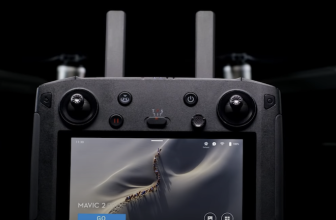
Access of 3rd Party Applications:
Pilots having experience in flying drones with third party app can access drone app ecosystem for their for their Phantom 4 RTK with the SDK remote controller by simply plugging the device and installing DJI mobile SDK-enabled app to give full access of Phantom 4.
OcuSync Transmission and D-RTK 2 Mobile Station:
You obviously need a good range when using drone at a construction site. The Phantom 4 RTK can provide HD images and video from a distance of up to 7km and it is also supported by D-RTK 2 mobile station providing continuous data to the drone and forming accurate survey solution and it can also capture coordinates of any site, the mobile station and ocusync transmission enables the drone to gain centimeter level accurate data with the DJI Phantom 4 RTK.
Advantages of DJI Phantom 4 RTK
- Light weight and easy to transport
- Real time flight monitoring on app
- Obstacle avoidance
- Good control and user friendly interface
- Telemetry integrated into ground station
- RTK receiver and GNSS module allows real time data correction in ideal conditions
Disadvantages of DJI Phantom 4 RTK
- No terrain following
- RTK depends on working signals that can give errors if signals fail
- Fixed payload for RGB and Video
- Prevent good images above 328 ft
DJI Phantom 4 RTK: FAQs
- Can I fly the Phantom 4 RTK in other countries or regions?
- No, the Phantom 4 RTK has specific versions for different countries and/or regions. Users can check the version code on the product packaging or through the GS RTK app (go to Aircraft Information -> Firmware).
- What is the video transmission distance of the Phantom 4 RTK?
- The effective video transmission distance depends on your method of operation (such as the antenna position) and actual flight environment. In an open and unobscured environment, the maximum distance is 7 km when FCC compliant, and 5 km when CE compliant. (2.4 GHz).
- How long does it take to fully charge a Phantom 4 RTK battery?
- It takes roughly 60 minutes to fully charge a Phantom 4 RTK battery.
- Does the Phantom 4 RTK camera digital signal processor (DSP) support distortion correction?
- No, you can enable the distortion correction in the camera but the images will be less precise compared to distortion elimination in post-processing software.
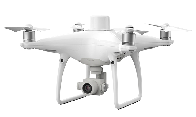
Design and Specs Table:
The Phantom 4 RTK is an easy to use drone, reliable and flexible and you can easily pick it up to the construction site, it has a base station and also built-in screen through which you can analyze and monitor the data and the app is programmed according to user friendly interface.
Aircraft
| Takeoff Weight | 1391 g |
| Diagonal Distance | 350 mm |
| Max Service Ceiling Above Sea Level | 19685 ft (6000 m) |
| Max Ascent Speed | 6 m/s (automatic flight); 5 m/s (manual control) |
| Max Descent Speed | 3 m/s |
| Max Speed | 31 mph (50 kph)(P-mode) 36 mph (58 kph)(A-mode) |
| Max Flight Time | Approx. 30 minutes |
| Operating Temperature Range | 32° to 104° F (0° to 40℃) |
| Operating Frequency | 2.400 GHz to 2.483 GHz (Europe, Japan, Korea) 5.725 GHz to 5.850 GHz (United States, China) |
| Transmission Power (EIRP) | 2.4 GHz CE (Europe) / MIC (Japan) / KCC (Korea) :< 20 dBm 5.8 GHz SRRC(China) / FCC(United States)/NCC(Taiwan,China):< 26 dBm |
| Hover Accuracy Range | RTK enabled and functioning properly: Vertical:±0.1 m;Horizontal:±0.1 m RTK disabled Vertical:±0.1 m(with vision positioning ); ±0.5 m(with GNSS positioning) Horizontal:±0.3 m(with vision positioning); ±1.5 m(with GNSS positioning) |
| Image Position Offset | The position of the camera center is relative to the phase center of the onboard D-RTK antenna under the aircraft body’s axis:(36, 0, and 192 mm) already applied to the image coordinates in Exif data. The positive x, y, and z axes of the aircraft body point to the forward, rightward, and downward of the aircraft, respectively. |
Mapping Functions
| Mapping Accuracy ** | Mapping accuracy meets the requirements of the ASPRS Accuracy Standards for Digital Orthophotos Class Ⅲ ** The actual accuracy depends on surrounding lighting and patterns, aircraft altitude, mapping software used, and other factors when shooting. |
| Ground Sample Distance(GSD) | (H/36.5) cm/pixel, H means the aircraft altitude relative to shooting scene (unit: m) |
| Data Acquisition Efficiency | Max operating area of approx. 1 km² for a single flight(at an altitude of 182 m, i.e., GSD is approx. 5 cm/pixel, meeting the requirements of the ASPRS Accuracy Standards for Digital Orthophotos Class Ⅲ |
Vision System
| Velocity Range | ≤31 mph(50 kph) at 6.6 ft(2 m) above ground with adequate lighting |
| Altitude Range | 0-33 ft(0 – 10 m) |
| Operating Range | 0-33 ft(0 – 10 m) |
| Obstacle Sensing Range | 2-98 ft(0.7-30 m) |
| FOV | Forward/Rear: 60° (horizontal), ±27° (vertical) Downward: 70° (front and rear), 50° (left and right) |
| Measuring Frequency | Forward/Rear:10 Hz; Downward: 20 Hz |
| Operating Environment | Surfaces with clear patterns and adequate lighting(> 15 lux) |
Camera
| Sensor | 1″ CMOS; Effective pixels: 20 M |
| Lens | FOV 84°;8.8 mm / 24 mm(35 mm format equivalent:24 mm); f/2.8 – f/11, auto focus at 1 m – ∞ |
| ISO Range | Video:100-3200(Auto) 100-6400(Manual); Photo:100-3200(Auto) 100-12800(Manual) |
| Mechanical Shutter Speed | 8 – 1/2000 s |
| Electronic Shutter Speed | 8 – 1/8000 s |
| Max Image Size | 4864×3648(4:3); 5472×3648(3:2) |
| Video Recording Modes | H.264,4K:3840×2160 30p |
| Photo Format | JPEG |
| Video Format | MOV |
| Supported File Systems | FAT32(≤ 32 GB); exFAT(> 32 GB) |
| Supported SD Cards | MicroSD, Max Capacity: 128 GB. Class 10 or UHS-1 rating required Write speed≥15 MB/s |
| Operating Temperature Range | 32° to 104° F (0° to 40℃) |
Intelligent Flight Battery(PH4-5870mAh-15.2V)
| Capacity | 5870 mAh |
| Voltage | 15.2 V |
| Battery Type | LiPo 4S |
| Energy | 89.2 Wh |
| Net Weight | 468 g |
| Charging Temperature Range | 14° to 104℉(-10° to 40℃) |
| Max charging Power | 160 W |
Intelligent Battery Charing Hub(WCH2)
| Input Voltage | 17.3 – 26.2 V |
| Output Voltage and Current | 8.7 V,6 A;5 V,2 A |
| Operating Temperature | 41° to 104℉(5° to 40℃) |
SDK Remote Controller
| Operating Frequency | 2.400 GHz to 2.483 GHz (Europe, Japan, Korea) 5.725 GHz to 5.850 GHz (Other countries/regions) |
| EIRP | 2.4 GHz CE / MIC / KCC: < 20 dBm 5.8 GHz FCC / SRRC / NCC: < 26 dBm |
| Max Transmission Distance | FCC / NCC: 4.3 mi (7 km); CE / MIC / KCC / SRRC: 3.1 mi (5 km) (Unobstructed, free of interference) |
| Built-in Battery | 6000 mAh LiPo 2S |
| Operating Current / Voltage | 1.2 A @ 7.4 V |
| Mobile Device Holder | Tablets and smartphones |
| Operating Temperature | 32° to 104° F (0° to 40° C) |
Conclusion:
In this scientific era it’s not hard to accept the fact that a flying equipment can provide so much easiness and efficiency to engineers with such accurate results. It’s all possible because of the Phantom 4 RTK that a construction site will take less time to complete which was not possible before the aerial survey and 3d modeling technology of DJI Phantom 4 RTK.

Jon is a passionate photographer and videographer who has been flying DJI drones for over 5 years. He loves the freedom and creativity that comes with capturing aerial footage and the unique perspective it provides. Jon is always on the lookout for new locations to explore and capture with his DJI drones. His favorite DJI drone is the Mavic 2 Pro, which he uses to capture stunning 4K footage with its Hasselblad camera. Jon is always eager to share his knowledge and experience with other drone enthusiasts and is a member of several online drone communities. When he’s not flying his DJI drone, Jon enjoys hiking, camping, and spending time with his family.